
This project has been funded with support from the European Commission.
This web site reflects the views only of the author, and the Commission cannot be held responsible for any use which may be made of the information contained therein.
This project has been funded with support from the European Commission.
This web site reflects the views only of the author, and the Commission cannot be held responsible for any use which may be made of the information contained therein.
Homepage > Learning Science through Nature > Geographical Areas
GEOGRAPHICAL AREAS
PICTURES
 |
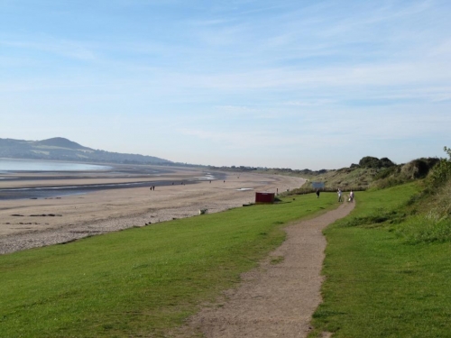
Tallaght students at Dublin Bay | The photograph shows the students getting ready to examine the place of natural interest. They chose to examine an area of shoreline on Dublin Bay. Dublin Bay is a C-shaped inlet of the Irish Sea on the east coast of Ireland. The bay is about 10 kilometres wide along its north-south base, and 7 km in length to its apex at the centre of the city of Dublin; stretching from Howth Head in the north to Dalkey Point in the south. North Bull Island is situated in the northwest part of the bay, where one of two major inshore sand banks lay, and features a 5 km long sandy beach, Dollymount Strand, fronting an internationally recognised wildfowl reserve. Many of the rivers of Dublin reach the Irish Sea at Dublin Bay: the River Liffey, with the River Dodder flow received less than 1 km inland, River Tolka, and various smaller rivers and streams. From north to south, Dublin Bay features beaches at Sutton Strand, Dollymount Strand on North Bull Island, Sandymount, Seapoint and south of Dun Laoghaire. The remaining coast is either rocky (with cliffs on Howth Head, for example) or mud coming up to sea walls. In most parts, the land slopes gently down to the sea, but aside from Howth Head, there are bluffs along much of the Raheny coastline, and the sharper slopes just inland at Monkstown and Old Dunlaoghaire. Dublin Bay viewed from Three Rock Mountain The metropolitan area of the city of Dublin surrounds three sides of the bay (the north, west, and south), while the Irish Sea lies to the east. Dublin was founded by the Vikings at the point where they were able to ford the River Liffey with the first wattle bridge up from the estuary. The city spread from its birthplace, around what is now the James\'s Gate area, out along the coastline, northeast towards Howth and southeast towards Dalkey. |
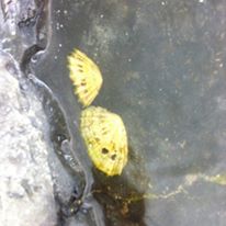 |
Limpets in rock pool | When the tide is in, limpets move over sea-covered rocks, scraping off tiny bits of seaweed. When the tide goes out, limpets clamp themselves very tightly against the newly exposed rock. This makes it difficult for predators to pull them off the rock to eat them. It also stops the limpets losing water, or being washed away by waves. Limpet teeth have recently been tested by researchers at the University of Portsmouth and found to be the hardest biological material in the world. |
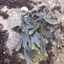 |
Fucus vesiculosus | Fucus is one of the most common seaweeds found on Irish shorelines. It is a mid-shore wrack easily recognised by its paired bladders occurring on either side of a prominent midrib. The frond is generally not strongly spiralled and the receptacles do not have a sterile rim (Fucus spiralis and F. guiryi), and the frond does not have a serrated margin (Fucus serratus). Fucus vesiculosus is attached by a small, strongly attached disc which gives rise to a short stipe. The reproductive receptacles are swollen area at the tips of fronds that have many flask-shaped cavities called conceptacles. These house the male and female reproductive structures known as antheridia (borne on antheridiophores) and oogonia (containing 8 eggs), respectively. The eggs and sperm are liberated onto the surface of the receptacles and a pheromone (sex-attracting substance) is released by the eggs that attracts the sperm. Fertilization results in a zygote that forms a new Fucus adult. A bladderless form occurs on more wave-exposed shores in the NE Atlantic. Fucus vesiculosus is used in cosmetic preparations and in thalassotherapy. |
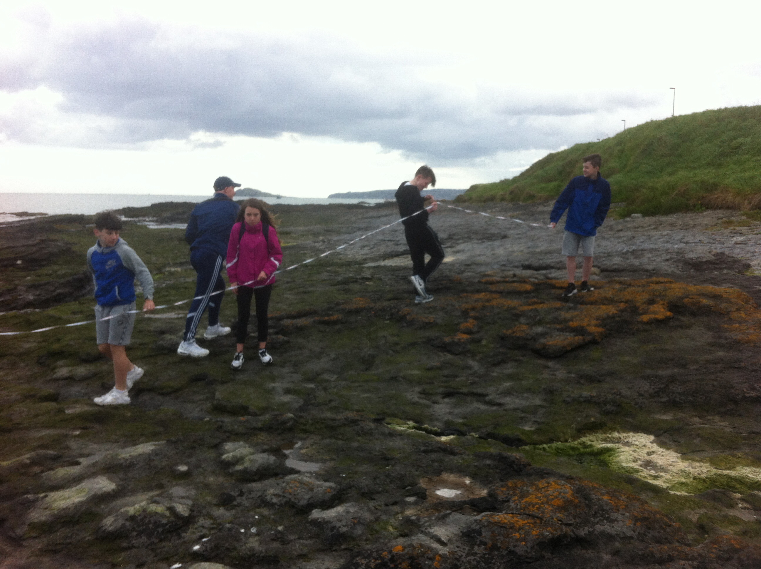 |
Transect at shoreline | The students and teachers chose to use traditional methods of ecological surveying, including the line transect. Many ecological surveys are carried out over extended periods of time, with sampling taking place at regular intervals within a particular habitat. In such cases, it is necessary to estimate the number of samples which should be taken at each sampling period. The minimum number of samples which should be taken to be truly representative of a particular habitat, can be ascertained by graphing the number of species recorded, as a function of the number of samples examined. A transect line can be made using a nylon rope marked and numbered at 0.5m, or 1m intervals, all the way along its length. This is laid across the area you wish to study. The position of the transect line is very important and it depends on the direction of the environmental gradient you wish to study. It should be thought about carefully before it is placed. You may otherwise end up without clear results because the line has been wrongly placed. For example, if the source of the pollutant was wrongly identified in the example given above, it is likely that the transect line would be laid in the wrong area and the results would be very confusing. Time is usually money, so it is worth while thinking about it before starting. A line transect is carried out by unrolling the transect line along the gradient identified. The species touching the line may be recorded along the whole length of the line (continuous sampling). Alternatively, the presence, or absence of species at each marked point is recorded (systematic sampling). If the slope along the transect line is measured as well, the results can then be inserted onto this profile. |
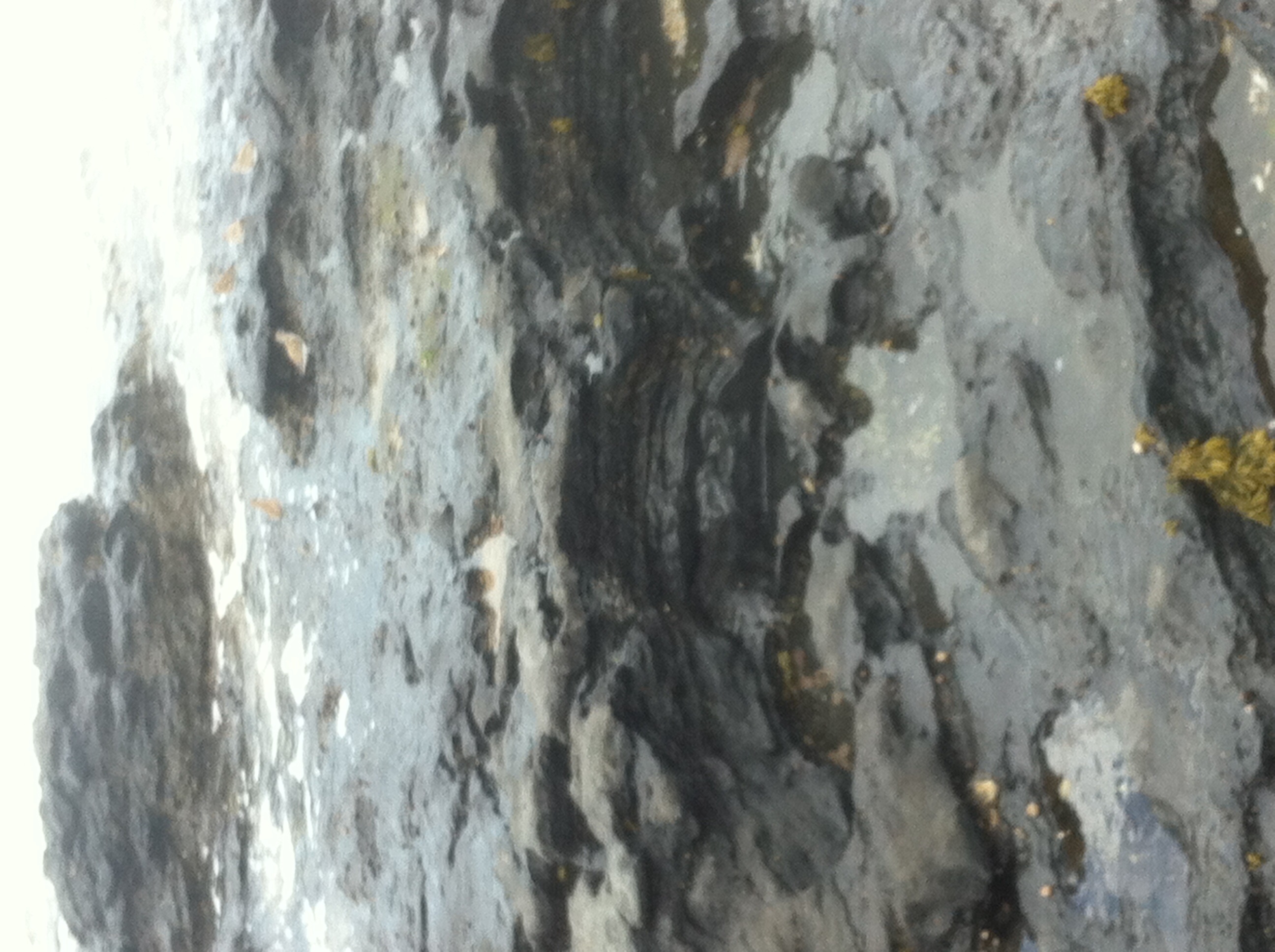 |
Carboniferous rock | Carboniferous interbedded limestones, calcareous mudstones and calcarenites underlie the majority of the Dublin Bay area. Evidence of ancient life may be found as fossils in sedimentary rocks of most ages. In Ireland, some of the most abundant and remarkable fossils are preserved in the Carboniferous limestone. They include single and colonial corals, shell fish known as brachiopods, sedentary stalked creatures called crinoids (relatives of the modern sea lily), scuttling trilobites that resemble giant wood lice, delicate net-like fronds called bryozoa, and spiral shells from snails. As well as these large visible fossils, there are many tiny ones that can only be seen clearly with the help of a microscope. These are called microfossils. The study of fossils is known as palaeontology. Fossils can be found almost everywhere that the Carboniferous limestone is exposed on the coast. |
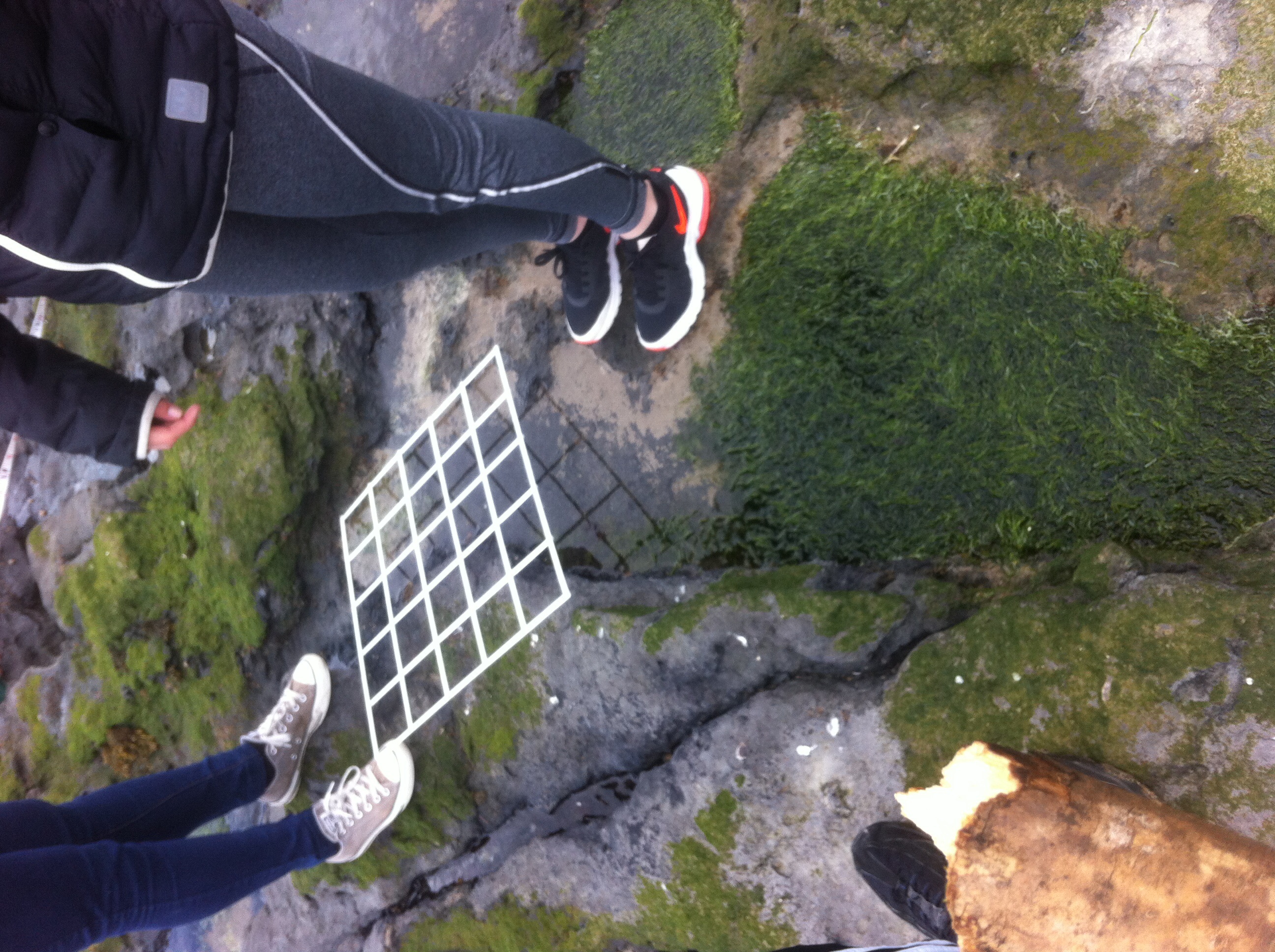 |
Quadrat surveying | Here the students are shown using a quadrat to survey the static populations in the rocky area. A quadrat is a simple device for marking out a small area. Pupils should understand how quadrats can be used to sample a larger area. By recording information from a number of quadrats placed within a larger study area, they can obtain a representative sample of the whole area, which may be too big to describe in full. In theory any shape of frame can be used but for many measurements you need to know the area of the quadrat so a square quadrat is the most popular. The size of the quadrat is usually related to the size of the plants being studied. Here are some useful guidelines, given in the Open University Project guide. •10 cm x 10 cm quadrats - for very small plants, such as algae or bryophytes on tree trunks or walls •25 cm x 25 cm quadrats - for short grassland and other low-growing vegetation •50 cm x 50 cm quadrats - for long grass or heathland |
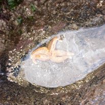 |
Starfish (Sea star) | Starfish are now being more correctly called sea stars because the starfish is not a fish. It is an echinoderm, closely related to sea urchins and sand dollars. There are some 2,000 species of sea star living in all the world’s oceans, from tropical habitats to the cold seafloor. The five-arm varieties are the most common, hence their name, but species with 10, 20, and even 40 arms exist. They have bony, calcified skin, which protects them from most predators, and many wear striking colours that camouflage them or scare off potential attackers. Purely marine animals, there are no freshwater sea stars, and only a few live in brackish water. Sea stars are famous for their ability to regenerate limbs, and in some cases, entire bodies. They accomplish this by housing most or all of their vital organs in their arms. Some require the central body to be intact to regenerate, but a few species can grow an entirely new sea star just from a portion of a severed limb. They are predators of bivalve molluscs and are also scavengers of dead marine organisms. |
 |
Symbiosis - lichen on carboniferous rock | A lichen is not a separate organism in the sense of being one type of individual. It is actually a close partnership between a fungus and an alga. The two types of organisms in the partnership are so closely interwoven that they appear as a single individual. This individual looks entirely different to either of the partner organisms making up the structure. Lichens are distinctive and they form many different, recognizable types. Many of these have been given specific names of their own, despite the fact that each lichen is already a mixture of different species. Lichens colonize some of the most inhospitable habitats on earth. They can survive in extremely cold areas such as on high mountains and in regions such as the arctic. They may be virtually the only plant form surviving in some of these areas and can be vitally important sources of food for animals. They are also found throughout less extreme climates, inhabiting just about any solid surface. This can range from rocks on sea shores, to walls, trees and concrete. A few are unattached and blow about freely. They can be used to make dyes for clothes, but are also excellent pollution indicators. |