
This project has been funded with support from the European Commission.
This web site reflects the views only of the author, and the Commission cannot be held responsible for any use which may be made of the information contained therein.
This project has been funded with support from the European Commission.
This web site reflects the views only of the author, and the Commission cannot be held responsible for any use which may be made of the information contained therein.
Homepage > Learning Science through Nature > Geographical Areas
GEOGRAPHICAL AREAS
PICTURES
 |
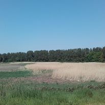
Coot at reed beds at Lough Derg | Lough Derg is a freshwater lake in the Shannon River Basin, Ireland. It is the second-biggest lake in the Republic of Ireland and the third-biggest on the island of Ireland (after Lough Neagh and Lough Corrib). It is a long, narrow lake, with shores in counties Clare (south-west), Galway (north-west), and Tipperary (to the east). It is the southernmost of three large lakes on the River Shannon; the others being Lough Ree and Lough Allen. Towns and villages on Lough Derg include Portumna, Killaloe & Ballina, Dromineer, Terryglass, Mountshannon and Garrykennedy. Lough Derg as a whole lake, its shoreline and islands are of huge ecological importance. This is reflected in the designations of Special Area of Conservation (SAC), proposed Natural Heritage Area (pNHA) and Special Protection Area (SPA) to the entire lake. A wide variety of bird species are found in the area. |
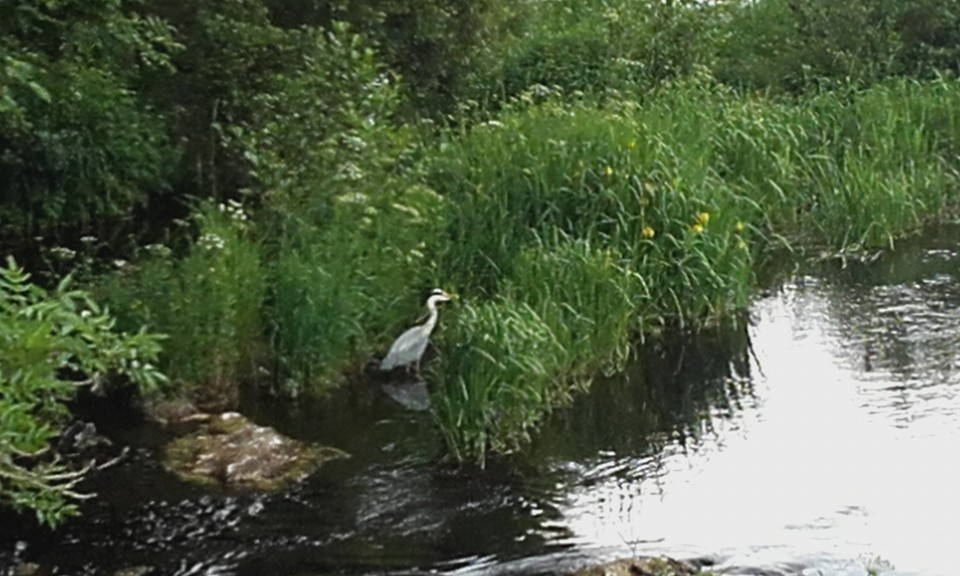 |
Grey heron on Shannon | Grey Herons are large grey and white birds with long yellow legs and bills. They are often seen standing motionless in or near water waiting to strike at their prey. Grey Herons are very territorial over their feeding areas. They are common residents at wetlands, estuaries and along rivers throughout Ireland. They are Green-listed in Ireland. The European population is considered to be Secure. The grey plumage and stature of Grey Herons make them unmistakable. It is a very familiar species being widely distributed and a year-round resident in Ireland. Single birds are often flushed when posed motionlessly at the edge of water bodies, coiled ready to strike out at unsuspecting prey with its formidable spear-like bill. It feeds along the edge of a wide range of wetland habitats from coastal waters and estuaries to loughs, streams and marshy ground. They are usually encountered as solitary birds and sometimes as a pairs, although if observing breeding colonies - heronries - numbers can be in the 50s. They call with loud harsh croaking often given in flight. Their diet is Fish, amphibians, small mammals, insects and reptiles. |
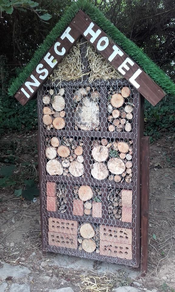 |
Intervention: Insect hotel | An insect hotel is a manmade structure created from natural materials intended to provide shelter for insects. They can come in a variety of shapes and sizes depending on the specific purpose or specific insect it is catered to. Most consist of several different sections that provide insects with nesting facilities – particularly during winter, offering shelter or refuge for many types of insects. Many insect hotels are used as nest sites by insects including solitary bees and solitary wasps. These insects drag prey to the nest where an egg is deposited. Other insects hotels are specifically designed to allow the insects to hibernate, notable examples include ladybirds (ladybugs) and butterflies. Insects hotels are also popular amongst gardeners and fruit and vegetable growers due to encouraging insect pollination. |
 |
Wetlands between Tullyvaraga and Illaunamanagh Point Shannon Town | Shannon Town Trails consists of two loops around Shannon Town of between one and two and half hours taking in the scenic area around the estuary. Shannon Estuary Loop Hastings Farmhouse was one of a number of farmhouses located along the old routeway into Tullyvarraga which can still be traced today along what is known as the Slí na Mara boreen. The farmhouse was located at the end of the boreen close to Illaunamanagh Point and within a few hundred metres of the Shannon Estuary. The site is beautifully sheltered in the lee of the hillside. The students walked this loop and studied the topography and flora and fauna they met along the way. |
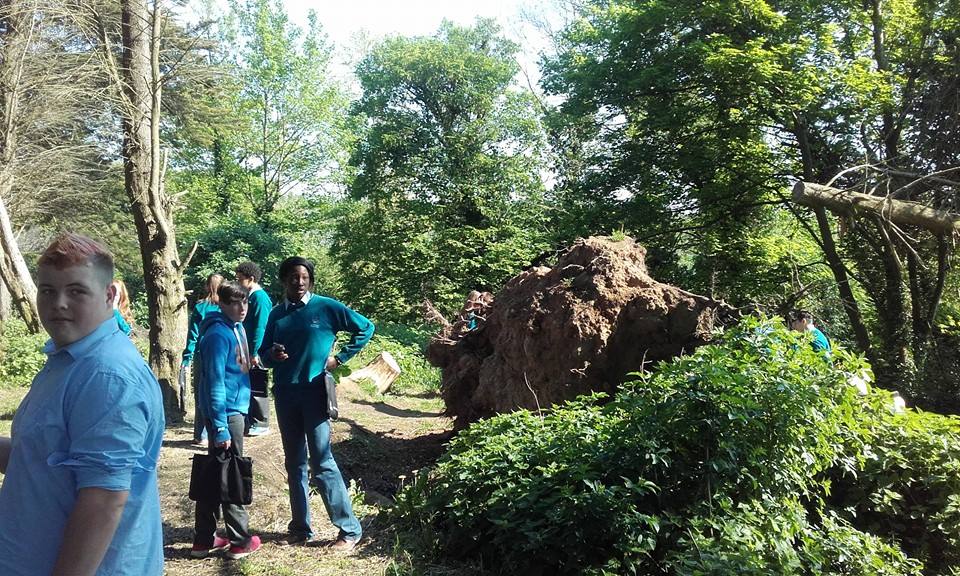 |
Storm-felled tree | Close to the shoreline of the estuary there was a copse of coniferous trees. As with many other woodlands in Ireland, storm damage from Storm Desmond. Storm Desmond was an extratropical cyclone and fourth named storm of the 2015–16 UK and Ireland windstorm season, notable for directing a plume of moist air, known as an atmospheric river, which brought record amounts of orographic rainfall to upland areas of northern Atlantic Europe and subsequent major floods. In Ireland the worst affected areas were in the Shannon River Basin in the west and Irish midlands. |
 |
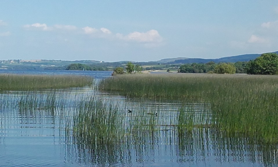
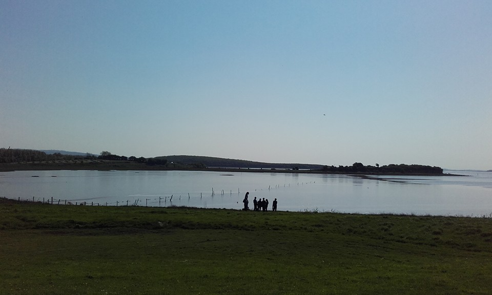
Shannon wetlands between the points at Shannon town | The Shannon Estuary is subject to permanent marine inundation with a tidal flow in a generally west to east aligned main channel that measures almost 100 km from its mouth to Limerick City. The estuary is macrotidal, having the largest tidal range (5.44 m at Limerick Docks) on the Irish coast. Water depths vary from c.37m at the estuary mouth to less than 5m near Limerick City. The inner Shannon estuaries feature vast expanses of intertidal mudflats. In the innermost parts of estuaries are tidal channels or creeks fringed with Common Reed (Phragmites australis) and Clubrushes (Scirpus maritimus, S. tabernaemontani and S. triquetrus). Saltmarsh vegetation frequently fringes the mudflats. Over twenty areas of estuarine saltmarsh have been identified within the site. The Shannon Airport Lagoon is an artificial saline lake that was developed in the 1940’s when a seawall was constructed out to the estuary to prevent Shannon Airport from flooding. Water levels are managed via a sluiced outlet and the lagoon is surrounded by a diverse range of habitats including saltmarsh, reed bed and freshwater marsh. This man-made feature has become a local biodiversity hot-spot and a well-known local birding area. |
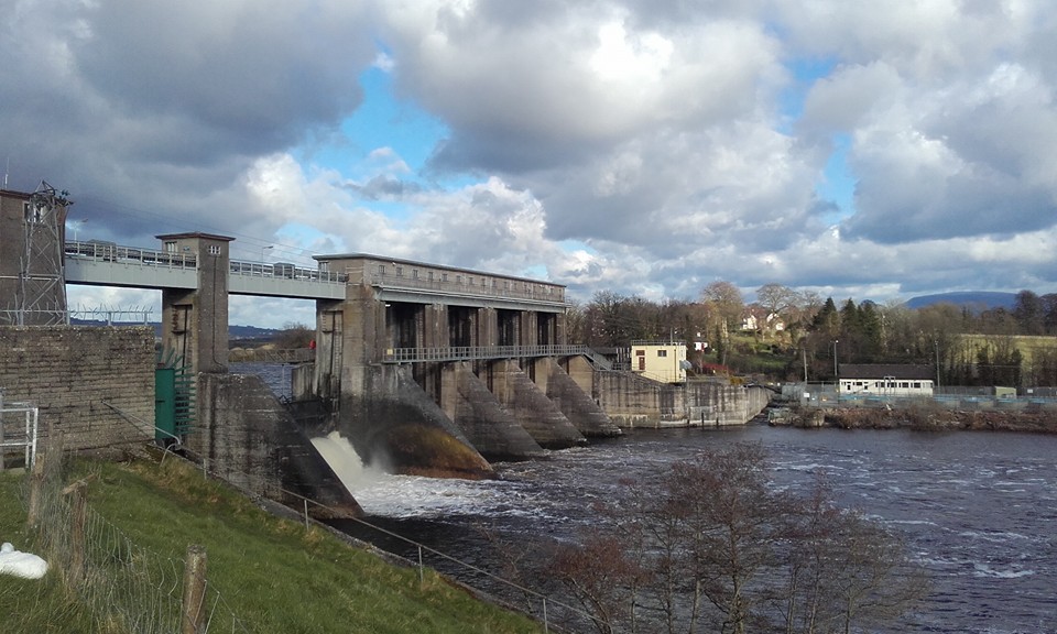 |
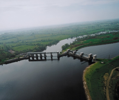
Parteen dam between Lough Derg and River Shannon | This intervention utilised water power to provide rural electrification in Ireland in the early twentieth century. Parteen Regulating Weir controls the flow of water to Ardnacrusha Hydroelectric Station and to the Old River Shannon. The compensation flow provided to the old river is just 10 cubic meters per second (cumecs), which is equivalent to the natural 95 percentile flow (an extreme drought flow) in the river prior to the Shannon Scheme. The rest of the water from the River Shannon is diverted down the headrace canal to Ardnacrusha Hydroelectric Station. The opening of the scheme had, and continues to have, a significant environmental effect on the part of the Shannon bypassed by the head-race canal, from Parteen Villa north of O\'Briens Bridge to about a mile north of Limerick city. This length of river, especially that running past Castleconnell and the Falls of Doonass was in the nineteenth and early twentieth centuries world famous for fishing, particularly Salmon fishing. The diverting of water to the power station had a disastrous effect on this, for two main reasons: Initially, there was no fish pass at Ardnacrusha to allow the salmon to migrate further up the river; this was later rectified. Secondly, the reduction in water flow down the natural channel encouraged more fish to either migrate towards the head-race canal, or to the Mulkear river instead. The problem continues to this day, and the salmon fishing is no longer comparable with the period up to the 1920s. Other species of native fish have also been affected by the low water levels. |
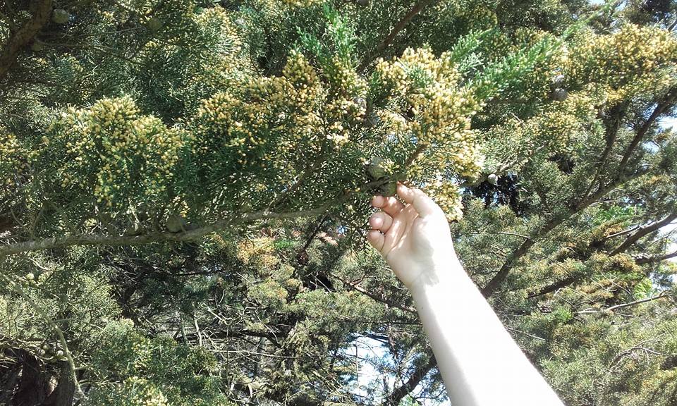 |
New growth on pine trees by riverbank | Pine trees are evergreen, coniferous resinous trees (or, rarely, shrubs) growing 3–80 m (10–260 ft) tall, with the majority of species reaching 15–45 m (50–150 ft) tall. The students found a small copse of pine trees during their walk to the point. The bark of most pines is thick and scaly, but some species have thin, flaky bark. The branches are produced in regular \"pseudo whorls\", actually a very tight spiral but appearing like a ring of branches arising from the same point. Many pines are uninodal, producing just one such whorl of branches each year, from buds at the tip of the year\'s new shoot, but others are multinodal, producing two or more whorls of branches per year. The spiral growth of branches, needles, and cone scales are arranged in Fibonacci number ratios.[citation needed] The new spring shoots are sometimes called \"candles\"; they are covered in brown or whitish bud scales and point upward at first, then later turn green and spread outward. These \"candles\" offer foresters a means to evaluate fertility of the soil and vigour of the trees. Pines are long-lived, typically reaching ages of 100–1,000 years. |
DRAWINGS
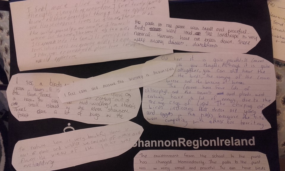 |
Student reflections on the study area. | We asked the students to write down what they were thinking as they carried out the nature study at the Shannon wetlands. This is just a selection of their thoughts. It was amazing that some of them who lived relatively close to the study section had never been there before. |